Geoportal
Scroll down for more explanations. Click here to maximise the geoportal.
Voor een optimale werking, raden wij aan deze pagina op een tablet of computer te bekijken.
How does the geoportal work?
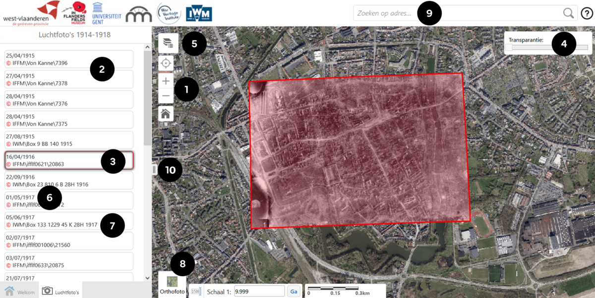
- Zoom in (to scale 1:10,000) and the available photos appear in a list on the left
- Move the mouse over the list and the outline of the photo is shown on the map
- Click on a frame to load a photo
- Adjust the transparency
- Select one of the four main front lines in the Westhoek or view the outlines of the photographs
- Aerial photograph date
- Information about the archive: IFFM / IWM / KLM-MRA
- Choose a background (map/current aerial photograph)
- Search by address
- Reduce or enlarge the left column
For other questions about the operation of the geoportal and the content of this website, please refer to the FAQ.


