Voor een optimale werking, raden wij aan deze pagina op een tablet of computer te bekijken.
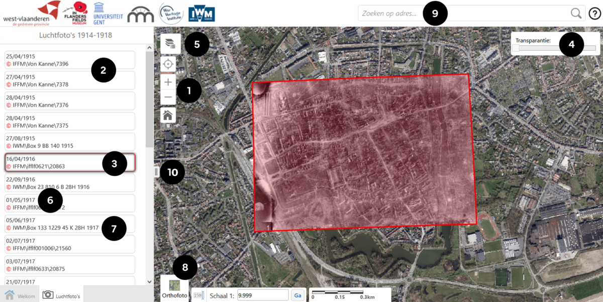
Discover the photos in 10 steps
- Zoom in (to scale 1:10,000) and the available photos appear in a list on the left
- Move the mouse over the list and the outline of the photo is shown on the map
- Click on a frame to load a photo
- Adjust the transparency
- Select one of the four main front lines in the Westhoek or view the outlines of the photographs
- Aerial photograph date
- Information about the archive: IFFM / IWM / KLM-MRA
- Choose a background (map/current aerial photograph)
- Search by address
- Reduce or enlarge the left column

For other questions about the operation of the geoportal and the content of this website, please refer to the FAQ.


